
Climbing Beacon Rock
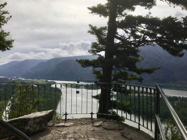
Towering right next to State Highway 14, Beacon Rock is the core of a volcano that last erupted about 57,000 years ago. At 848 feet high, some consider it one of the largest monoliths, or single rocks, in the world. An easy, fun, 1.8-mile out-and-back trail with 52 switchbacks takes you to the top.

The trail is the legacy of Henry J. Biddle, a geologist, engineer, conservationist, and scion of a prominent Philadelphia family. In the 1880s, he worked for the US Geological Survey in the Pacific Northwest, eventually retiring near Vancouver, Washington, in 1912. The story goes that in 1915 Biddle purchased what was then known as Castle Rock from Charles Ladd (son of a well-known banker and Portland mayor) for $1. Both men were concerned about US Army Corps of Engineers plans to blow up the rock for fill to construct jetties at the mouth of the Columbia River, which would make it safer for ships to cross the treacherous bar there.
Biddle was an enthusiastic hiker who focused his engineering skills on the task of building a trail to the top of Beacon Rock. It took three years, from 1915-1918, and today you can see much of the original infrastructure, including some decorative railings and bolts. Views of the Columbia River Gorge accompany you to the top. It is, well, really cool.


Biddle also persuaded the US Board of Geographic Names in 1916 to restore the monolith’s name to Beacon Rock, the moniker assigned to it more than a century before by Captain William Clark of the Lewis & Clark Expedition.
Lewis & Clark & Biddle
In fact, Clark first called it the “Beaten Rock,” describing it as a “remarkable high detached rock” as the explorers were headed west to the Pacific Ocean in autumn 1805. Significantly, it was near here that Clark noticed the first signs of tidal shifts, suggesting that they were close to their goal. The next spring, on their way home, Clark labeled it “Beacon Rock” in his journal. It’s not clear why the name changed. One theory is that “beaten” referred to its appearance, and “beacon” referred to its visibility from miles away.
So why was Biddle so keen to restore Clark’s name for the rock? Well, it turns out that one of Biddle’s ancestors was one Nicholas Biddle, a wealthy banker and political influencer who also happened to have written the first published account of the Lewis and Clark Expedition. Nicholas Biddle’s name doesn’t appear in the two-volume set, perhaps because he was elected to the Pennsylvania legislature and had to relinquish the almost-finished project. It seems likely that Henry Biddle wanted to honor his forefather by ensuring the monolith sported the name given it by William Clark.
Of course, Beacon Rock was known for millennia to native peoples before Euro-Americans showed up. The Chinook people called it Che-che-op-tin, which some have interpreted to mean “navel of the world.” Biddle himself could not explain that name in his entertaining booklet Beacon Rock on the Columbia, but believed the rock was sacred to local indigenous peoples. He described several carved and painted wooden figures found at its base in the early 1900s.


Henry Biddle died in 1928, and his children offered Beacon Rock to Washington State for a public park. Then-governor Roland Hartley declined, believing the family was trying to duck taxes. But when Washington leaders learned that the head of Oregon’s state parks wanted to buy Beacon Rock, they quickly decided to accept the gift. Beacon Rock became a state park in 1935.
Today, Beacon Rock is a rewarding leg-stretcher for drivers along Highway 14. It’s also popular with rock climbers. We saw a few scaling the lower reaches as we hiked down. Back at the bottom, we were ready to cross the highway and explore more of the park.

River to Rock Trail
At nearly 5,000 acres, Beacon Rock State Park is one of the largest in the state park system. In addition to the famous monolith, there are miles of trails that beckon. And you know I can’t resist a trail.
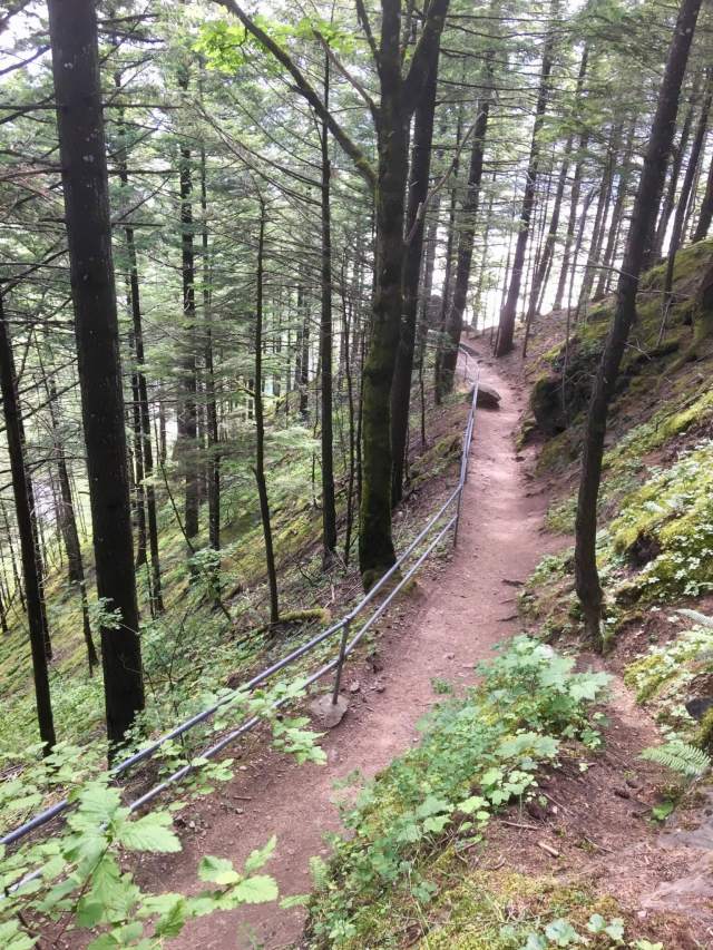
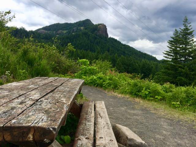
Mr. Adventure had a meeting a few miles away, but we had just enough time to hike the park’s newest trail, the 1.5-mile River to Rock Trail. We started at the “Rock” end, just west of the Beacon Rock trail, and followed the path through pretty woods and around a wetland to the river. From the wetland section, the view of Beacon Rock is classic.

We turned around at the trailhead and hiked back uphill to our car. Mr. Adventure headed to his meeting and I headed across the road to hike some more.
Waterfalls and Hamilton Mountain
I knew that if I wanted to maximize my time in the park, I couldn’t hike all the way to the summit of Hamilton Mountain, a popular day-hike destination that promises plenty of summer wildflowers and sweeping views from the top. But I did have enough time to hike about half of the trail, to the enticingly named Pool of the Winds.
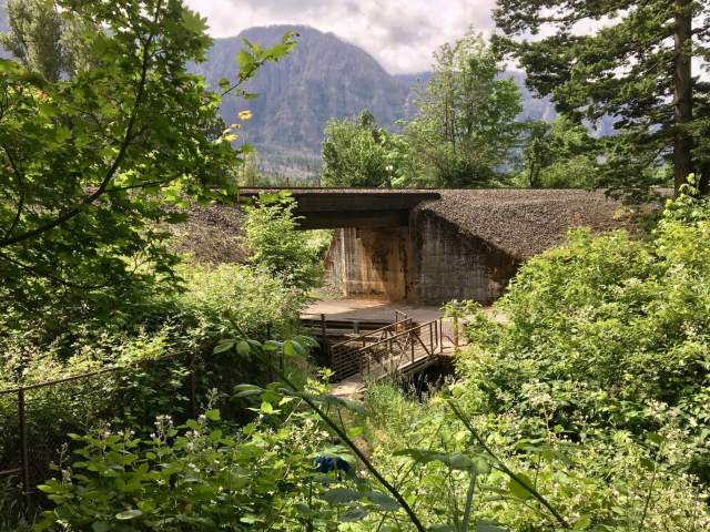
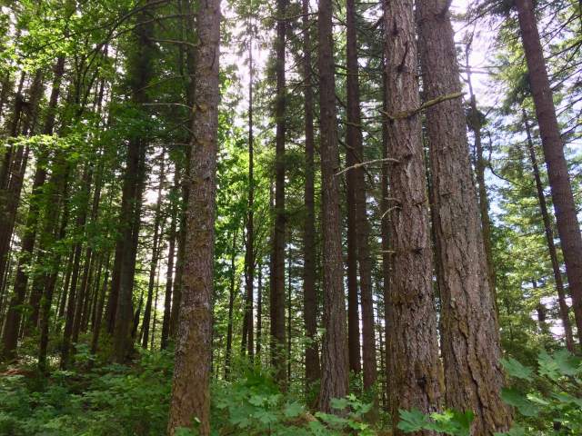
I left from the lower picnic area, a decision that meant the first half-mile was an uphill grind. But, the trail winds through beautiful old-growth Douglas-fir forest, a welcome compensation as I puffed upward. At 1.25 miles is a junction, beyond which is the trail to the summit. This was my turnaround point, so I headed down onto a short social trail, where I had a leaf-obscured view of Hardy Falls and the bridge over it.


It was the Pool of the Winds that intrigued me, so I went back uphill past the junction and took a short cutoff to Rodney Falls, which crashes down inside a narrow rock chasm. That enclosure creates the Pool of the Winds. As I stood on the rocks at the base of the falls, peering upward through the spray, a constant and refreshing breeze cooled me down.

When I returned to the trail junction, two women were standing there, chugging from water bottles before continuing up the the summit trail. “It’s really worth it to go up to the Pool of the Winds,” I enthused. “It’s just a few yards up this trail–look, you can see the overlook.” They looked at me as if I had three heads and quickly turned away onto the Hamilton Mountain trail. Their loss.
I took a different trail back, one that kept me higher on the slopes and passed under some power lines emanating from Bonneville Dam, a few miles east on the Columbia River. As it turned out, this decision meant I would see a lot more of the trail system than I had planned. Excellent!

The other Beacon Rock and the Hadley Trail
I had returned along the Hadley Trail, and although I didn’t know exactly where I would end up I figured I’d be able to find my car eventually. After a half-mile of hiking, I came to a junction signed for Little Beacon Rock. Huh? There’s another Beacon Rock? I had to check it out.

After a short, flat walk through a forest, I came out onto a talus field. A ground squirrel scurried into a burrow just in front of me. Two short switchbacks later, I was standing on a saddle with Little Beacon Rock to my left and Big Beacon Rock in front of me. I felt like I’d stepped through a hidden doorway to a secret part of the park. It was just me and the ground squirrels.


At this point, I was thinking, “Mr. Adventure has got to hike this later.” I knew he’d love it.
I left Little Beacon Rock and rejoined the Hadley Trail, continuing through a stately grove of trees named for the park’s first superintendent, Clyde Hadley. After a short downhill stretch, I reached the trailhead, which I realized is in the park campground about a half-mile by road above the lower picnic area where my car was parked.

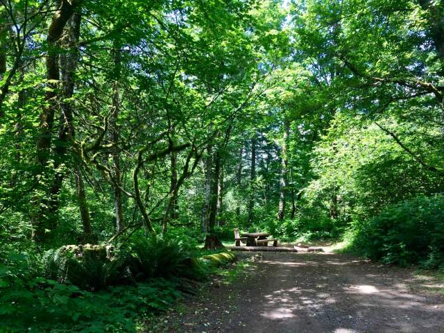
I walked through the remarkably pretty campground, admiring how the 26 sites were spaced to give campers both privacy and territorial views. A couple of campsites are located below a rock bluff, and I made a mental note to return here during spring or fall to camp for a couple of nights. Leaving the campground, I noticed the entry sign said “Built by the CCC 1939-41.” More history!

The CCC at Beacon Rock
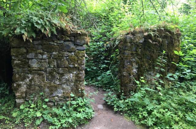
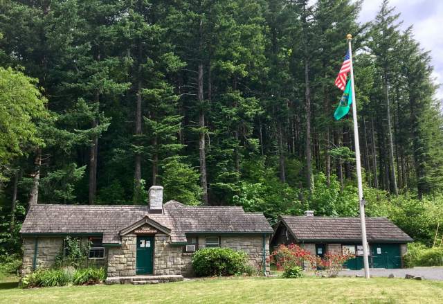
I headed down the road toward the lower picnic area and my car, passing a turnoff for the upper picnic area along the way. Back at the Hamilton Mountain trailhead where I’d started, I walked past the play area to check out a handsome stone shelter. Like the campground, it was built by the Civilian Conservation Corps, which had a camp there beginning in 1935. The park houses several striking CCC structures, including park headquarters and the quirky park sign on Highway 14.
This picnic shelter, though, was simply gorgeous. Stones were carefully fitted together and mortared for the exterior, while big, solid wood beams added warmth and character inside. Even the original stone fireplace is there. It would be a fine place to wait out a rain shower or find shade on a hot day and admire an excellent example of CCC “parkitecture.”


The CCC also constructed the Hamilton Mountain, Hadley, and Little Beacon Rock trails that I’d enjoyed earlier, and improved Henry Biddle’s original trail up Beacon Rock. I sent a silent thank-you to the CCCers who left such a wonderful legacy at Washington state parks.
The Doetsch Ranch: last stop
It was early afternoon and I’d gotten a good taste of Beacon Rock State Park’s many wonders, but I still had a little time before I needed to pick up Mr. Adventure, so I decided to do one last trail. The Doetsch Walking Path is a paved, 1.2-mile loop around an old pasture next to the Columbia River.
I spotted two eagles in a tree that leaned out over the water, and enjoyed the feel of the sun on my shoulders as I strolled the path. A few people were setting up picnics as I finished the trail.

Reading the interpretive sign about Lewis and Clark near the parking area, I thought about Beacon Rock’s significance. For native peoples, Lewis and Clark, fur traders, settlers, Henry Biddle, the Civilian Conservation Corps, and thousands of visitors today, it’s been a sacred site, landmark, guidepost, natural resource, geological wonder, and recreational destination. History and culture are layered thickly on the ground here. This is a park that merits leisurely exploration of its trails and forests and meadows. It’s truly a crown jewel in the Washington state park system.
(And if you’re wondering, yes, Mr. Adventure came back with me later that afternoon and hiked to the Pool of the Winds and Little Beacon Rock. He loved it.)
Fast facts about Beacon Rock State Park
- 4,464-acre, camping park, open year-round
- 9,500 feet of freshwater shoreline on the Columbia River
- $10 daily parking pass (buy the annual Discover Pass, a bargain at $30)
- hiking trails, equestrian trails, mountain biking, rock climbing, boating, fishing, kiteboarding, playground
- boat launch, moorage, pump-out station
- showers in main campground and moorage area
- picnic tables, restrooms
- 26 tent campsites in main campground (closed in winter), two primitive sites at equestrian trailhead and at moorage, all first-come, first-served
- five year-round RV campsites with electric, water, and sewer at Woodard Creek Campground, first-come, first-served, max length 40′
- group camp for up to 200 people, reservable online or call 888-CAMPOUT; closed in winter
- two day-use kitchen shelters for up to 100 people each, reservable online or call 888-CAMPOUT
- park brochure
- park map